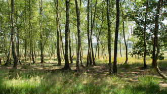
Elmpter Schwalmbruch © Elke Wetzig/CC BY-SA 4.0
download picture
main content
Project
AREA IN FOCUS
Project region
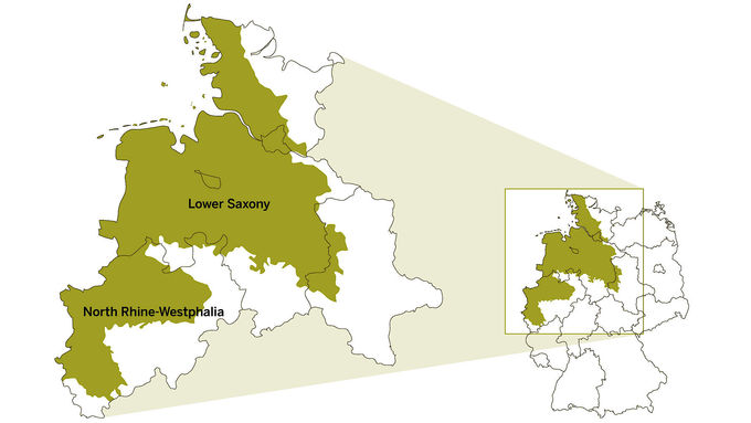
The European Union has nine biogeographical regions, each with its own characteristic blend of vegetation, climate and geology (while Europe as a whole has eleven biogeographical regions). They are a zone model within the European Union and serve in particular as a basic grid for the evaluation and selection of Natura 2000 sites. They each have specific characteristics in regard to occurring species and habitats. The so-called “Atlantic Region” marks the coastal Northwest Europe and aside from parts of Germany comprises regions in Belgium, Denmark, France, Portugal, Spain and the United Kingdom as well as Ireland and the Netherlands.
In Germany, this biogeographical region covers about 70,000 square kilometres, corresponding to 20 percent of the terrestrial land cover and stretching over the western part of the North German Plain. The majority (about 80 percent) lies within North Rhine-Westphalia and Lower Saxony; the remaining area is distributed among the city states of Bremen and Hamburg as well as parts of Schleswig-Holstein and Saxony-Anhalt. In North Rhine-Westphalia, the Atlantic Region is roughly divided into the Westphalian Bight with the rivers Lippe and Ems, the Low Rhine Plain on both sides of the river Rhine as well as the Cologne Bight, while in Lower Saxony the Atlantic Region covers the Marshland, the North German Geest, the Lüneburg Heath and the Börde Area. The most important rivers in Lower Saxony are the Elbe, Weser and Ems, while some tributaries like Aller or Hase ought to be mentioned as well, as they serve as a basis for riparian inland dunes with the resulting habitats. The Atlantic Region is bounded in the South by the Central European Low Mountain Range (Rhenish Slate Mountains, Lower Saxon Hills, Harz) and in the East by the Eastern Harzvorland and Börden, the Wendland as well as the Schleswig-Holstein Uplands. Between North Rhine-Westphalia and Lower Saxony, the almost parallel low mountain ranges of the Wiehen Hills and the Teutoburg Forest, which belong to the Continental Region, extend far to the Northwest into the Atlantic Region.
Large areas of this region are shaped by dense human population and intensive agriculture (e.g. the Münsterland in North Rhine-Westphalia and the Emsland in Lower Saxony). Therefore, the habitats and species within these landscapes are threatened by a multitude of interests. As the results of the 2013 Report under the Habitats Directive have shown, to date the conservation statuses of the habitat types and species in the Atlantic Region are predominantly assessed as unfavourable inadequate to bad (48 and 39 percent respectively). Degradation in regard to quantity, quality or interconnectedness of habitats is the underlying cause. This is particularly true for the nutrient-poor habitats and their characteristic species within the Atlantic Region. Only 20 percent of the conservation statuses of species and 17 percent of habitat types are assessed as favourable.