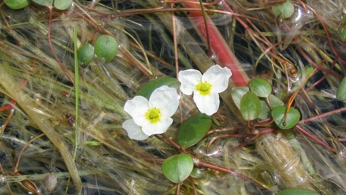
Flowering floating water-plantain (Luronium natans) © Annette Schulte Bocholt †, Biological Station of the district of Recklinghausen
download picturemain content
Project of the month
#10/2024 Marsh area ‘Wienbecker Mühle’
Optimization of habitat for the floating water-plantain in the district of Recklinghausen
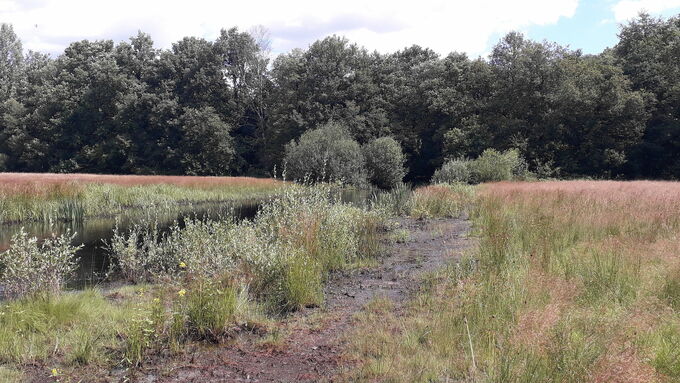
The area ‘Feuchtwiese an der Wienbecker Mühle’ to the west of Dorsten-Wulfen in the district of Recklinghausen, designated as a nature reserve in 1984, is an extensively managed wetland with a temporarily water-bearing, partially widened ditch on the sandy low terrace. Due to the occurrence of the floating water-plantain (Luronium natans), the area owned by the district of Recklinghausen was registered as coextensive SAC ‘Wienbecker Mühle’ (DE-4207-304). The Luronium occurrence is one of the few in the Atlantic biogeographical region in North Rhine-Westphalia and is therefore of particular importance in the biotope network. Accordingly, its preservation as a stepping stone biotope in the network for species of nutrient-poor water bodies is also listed as a conservation objective in the concept of measures.
However, due to the increase in nutrient inputs, particularly from the air, and the associated increase in nutrient indicators, the habitat quality is severely impaired. The constant existing Luronium population of 20-25 square metres fluctuates in its overall conservation status between ‘favourable’ and ‘unfavourable - bad’. An improvement in habitat quality was therefore urgently required. As part of the ‘LIFE Integrated Project Atlantic Region DE’, habitat work for habitat optimization were therefore carried out in September/October 2024 in cooperation with the Biological Station in the district of Recklinghausen and the Lower Nature Conservation Authority of the district of Recklinghausen. In addition to improving habitat quality, the action aimed to increase the Luronium population and the habitat type ‘oligotrophic to mesotrophic standing waters with vegetation of the Littorelletea uniflorae and/or of the Isoeto-Nanojuncetea’ (habitat type 3130). As part of the action, the south-western part of the ditch which is currently still mapped as a standing water body (NFD0) was desludged and cleared of vegetation. The aim was to align it with the north-eastern section to create a larger and less overgrown water area. In addition, the willow bushes overgrowing the edge of the ditch were removed and the entire area was thinned out so that it can be managed as a meadow in future.
The first step was to create an access route. For this purpose, a route with slabs was laid on the southern part of the meadow to ensure that the high-quality wetland was not affected by the work. The first few metres of the access route had to be gravelled due to its steep gradient. The layer of broken stones was placed on a tarpaulin so that it could be removed free of residues once the works were completed. Thereafter, the water body could be desludged with an excavator. The resulting material was disposed of.
Related topics
Further links
- Biological Station of the district of Recklinghausen (in German) (external link opens in a new window)
- District of Recklinghausen – Lower Nature Conservation Authority (in German) (external link opens in a new window)
- SAC ‘Wienbecker Mühle’ – State Agency for Nature, Environment and Consumer Protection (LANUV) (in German) (external link opens in a new window)


